Railroad Commission of Texas Completing Transition to Digital Format
Monday I discovered that my links on the RRC website were non-functional. After a brief search I discovered that they had redesigned the main page and assigned new URLs to a number of pages. Today I found the brand new, marvelously modern, Enhanced GIS Viewer. The old clunky GIS viewer is still available until they have the new one fully functional. I suggest that you start bookmarking the new pages because the old pages will be available until July 1, 20014 but they are not being updated. I'll give you the links I use most and you should be able to find everything else from those:
HOME: Main Page, less newsy. They seem to be going for "purely functional", no images now. I hope it's much more logical, as well.
Research and Statistics: Has lots of nerdy aggregate data but this is where you find the Operator Directory (all operators registered @ RRC with their contact information) and Proration Schedules (list of all active wells sorted several different ways), mineral owners.
Online Research Queries: Every search function available on RRC should end up on this page, once they have finished. Both of the GIS viewers, the new Enhanced GIS Viewer and the old Legacy GIS Viewer have a link here. Check out these links to the two viewers and you'll see why I'm so excited about the new one.
I can't say, yet, what the search capabilities will be from the new viewer because they haven't finished adding everything, as it appears now. Keep checking back. There are now several options for the base map:


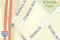


There are measuring tools for both distance (miles) and acres, a lat-long tool where you can enter coordinates and view that location or find the coordinates of a well on the map. There is a tool to draw a radius (or multiple radii), of the size you type in, around your focal point. Lots of new options... so, take a few minutes to explore the possibilities.
Tags: Railroad Commission of Texas
Views: 1024
Replies to This Discussion
-
Permalink Reply by jffree1 on
-
Update: If you click "Visibility", on the left side of top toolbar, you can add layers to the base map. On this one, I have added pipelines to Nacogdoches County. It takes a couple of minutes for the details (wells, pipelines) to populated the map but once they do you can click on "Identify" in the toolbar for a drop down list of items. Choose pipelines and hover the cursor over a line and a box will appear with the name of the line and the operator (I would suggest that they ought to add the T-4 permit #, too). Exploring...
-
-
Update: If you have the pipeline layer visible you can get the name of the pipeline and operator just by hovering the cursor over a line. For more detailed info such as the T-4 Permit # (which I was grousing about earlier...) click on "Identify": pipelines (in the drop down list) and then click on the pipeline you want info on. Another window will open with any additional info available. Same for wells.
-
-
You're welcome. I thank RRC for working hard to fix their site. The new GIS Map is the icing on the cake.
-
 Permalink Reply by Bill R on
 -
I love this tool, however there seems to be an incredible lag time on some of the downloads... even with my FIOS connection the layering took 2 - 4 minutes for all of the details to populate. Well worth the wait, but dang if I didn't feel like I was back on dial up!
I think the RRC has come a long way through the years and I really appreciate your little tutorials on some of this stuff... without you, too many of us would be lost!
-
-
Bill, I used the map in the middle of the day and it was really slow. Later, about 6:30, it was much faster. I am guessing that they are still working on it and that the traffic may be fairly heavy for a while with people just checking it out. Give it a little time, I say.
-
Permalink Reply by Bill R on
-
Jeffree1 - Is there any place on the site where we can access well permit information by County? I have been looking around, however have not been able to locate yet.... and figured if anyone knows, it would be you! Thanks in advance! ><(((( * ,>
-
-
We have always been able to pull up permits by county, Bill. See the drop down list of counties on the top right of the permit query page.
Also, you can limit your search by operator, field, depth, profile, status, etc... just keep in mind that everything you select or write in will have to be true to return results. In almost all cases on RRC searches, less is more. The more stuff you select the greater the chance that you will get no results.
-
Permalink Reply by Bill R on
-
Thank you.... I will try that... most likely I was on when everyone else was and at about mid day!
And I will try the query page again... didn't do what I wanted the first time around
-
Permalink Reply by Mister Sunday on
-
Great! Thanks for the heads-up!
Support GoHaynesvilleShale.com
Top Content
Groups
-
WESTERN HAYNESVILLE
7 members
-
San Augustine, TX
386 members
-
SMACKOVER LITHIUM GROUP …
5 members
-
SMACKOVER LITHIUM GROUP …
5 members
-
Bienville Parish, LA
247 members
-
Natchitoches Parish
401 members
-
SMACKOVER LITHIUM GROUP …
5 members
-
Franklin County, Texas
11 members
-
North Caddo Parish
360 members
-
DeSoto Parish
689 members
Blog Posts
Tuscaloosa Trend Sits On Top Of Poorest Neighbourhood For Decades - Yet No Royalties Ever Paid To The Community -- Why??
In researching the decades-old Tuscaloosa Trend and the immense wealth it has generated for many, I find it deeply troubling that this resource-rich formation runs directly beneath one of the poorest communities in North Baton Rouge—near…
ContinuePosted by Char on May 29, 2025 at 14:42 — 4 Comments
Not a member? Get our email.
© 2025 Created by Keith Mauck (Site Publisher).
Powered by
![]()